• There were many reasons for the change of the site software, the biggest was security. The age of the old software also meant no server updates for certain programs. There are many benefits to the new software, one of the biggest is the mobile functionality. Ill fix up some stuff in the coming days, we'll also try to get some of the old addons back or the data imported back into the site like the garage. To create a thread or to reply with a post is basically the same as it was in the prior software. The default style of the site is light colored, but i temporarily added a darker colored style, to change you can find a link at the bottom of the site.

Adding GPS to a 2019 RT Limited

I no longer use BRP Connect to display on my Spyders screen. So I have mounted the phone on my handlebars. I have a usb power plug on my handlebars if I need it to keep the phone charged. Never had a problem with the gps function. If I wanted to use BRP Connect and I have. I just run a usb cable from the glove box to the phone on the handlebars.
Will BRP connect work with a WiFi only tablet? I use a Samsung Tab A 8.0. The 8 inch screen makes it easy to see the GPS route! I'd move up to a 10 inch but there just isn't enough space between the dash, cluster, and handlebar for one.
 
Will BRP connect work with a WiFi only tablet? I use a Samsung Tab A 8.0. The 8 inch screen makes it easy to see the GPS route! I'd move up to a 10 inch but there just isn't enough space between the dash, cluster, and handlebar for one.

It should if the tablet functions now with a GPS program. It would have to be a program that BRP Connect will work with like Sygic. I have managed to connect my iPad Mini 4 but its not useful for GPS functions.
 
Will BRP connect work with a WiFi only tablet? I use a Samsung Tab A 8.0. The 8 inch screen makes it easy to see the GPS route! I'd move up to a 10 inch but there just isn't enough space between the dash, cluster, and handlebar for one.

The BRP Connect app is not available for a tablet. Not a compatable device. But that may not be what your asking because you want to use the tablet screen. Not sure if a tablet will BT pair with the Spyder dash. The spyder will want to pair in 2 modes. Handsfree profile HFP and advance audio distribution profile A2DP. Your tablet does not have HFP since its not a phone. Never tried it so not sure.
 
The BRP Connect app is not available for a tablet. Not a compatable device. But that may not be what your asking because you want to use the tablet screen. Not sure if a tablet will BT pair with the Spyder dash. The spyder will want to pair in 2 modes. Handsfree profile HFP and advance audio distribution profile A2DP. Your tablet does not have HFP since its not a phone. Never tried it so not sure.
Thanks. I was just curious. It doesn't surprise me since there would be no real advantage of using a tablet over a phone, other than cost, since the screen image is transferred to the cluster screen. IMO, for visibility of GPS screens, a tablet is the best!
 
Using something on a regular basis gets easier. Using the cluster screen and learning what it shows only gets better every time I get on the bike. I like Sygic as its easier and I can have the info I like showing along with the map. My phone is on top of the dash because it's easier to get at rather than putting it in the frunk. The GPS antenna in smartphones works almost anywhere so inside the frunk isn't a problem. If the phone's battery is less than half down it will get hot as its charging as well as working. So try and keep the battery more than half when traveling. Carry a iPad Mini for long usage?
 
One must remember the accuracy in a Garmin GPS finding an "accurate" route is a function of the currency of the map loaded in the GPS. Since Garmin's maps are proprietary they rely a good bit on users reporting errors; the number of corrections in updates depends on the squeakiness of the wheels.

Absolutely agree. All of our recent issues with our Garmins getting lost or confused, each had the most recent updates to the unit and the actual maps.

Regarding Garmins having proprietary maps, I learned years ago thatthis may not be the truth. An internet source called Open Street Maps as I understand it, is the database that Garmin obtains. Open Street Maps is a user type database. The database is free, and essentially covers the entire planet. Users of Open Street Maps create the database and constantly add updates.

Open street maps has routes for various modes of transportation. Driving, walking, cycling.

I am unsure where non Garmin navigation obtains its database.

As good as Garmin has been in the past, possibly the time has come that Garmin needs to utilize more cell based technology to assist true satellite navigation. As was mentioned, many modern cell phones have the ability to user select the source to navigate with. This could be WiFi based, Cell Tower based, Satellite based or a combination of what is best at the moment.

In this modern era, Garmin navigation should be simple, accurate, and adapt easily to a drivers desire to alter the route chosen by the device.

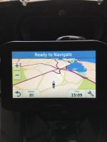
If our Garmin 660 could be converted to a Google Maps, or similar format when I deem it needs to, the Garmin hardware and mounting would complete a great setup. Having a Garmin with all updates that still gets confused or lost is never fun.
 
I've been told by Garmin that in about a year their support for the Garmin app will stop. They have removed it from the app stores as many are doing the cheap route and using Waze or Google maps. TomTom is still available for smartphone along with a few other GPS apps that have downloaded maps. I like Sygic as you can create a route just like Google compared to TomTom where you have to input many waypoints.
 
Garmin uses map data from Navtec.

Navigation on a phone cannot be done by cell tower communication. Not accurate enough. But some phones have a technology that uses cell phone data to assist navigation. Only really helpful in cities where skyscrapers cut off the gps signal and there are multiple cell antennas to communicate with.

Update: Navtec was bought out by HERE. Same map provider to several other apps.
Unless things have changed in the past year or so, Sygic uses map data from TomTom. Now what the underlying cartographic and GIS data is that TomTom uses I have no idea.
 
Do you have to pay for the maps for that too
If you are referring to Sygic, they offer a lifetime license for a one time fee. They charge by the country, i.e., US, Canada, Mexico, or some combination of them. They also have European maps. They issue free map updates three times a year and monthly updates for an annual subscription. Real time traffic alerts are one time charge. I don't know if the BRP Connect pricing program is the same or not.

Three years ago I ran into a situation a couple of times where the destination on the map was incorrect. I don't remember that being a problem these past two summers. The only thing that irritates me with it is that it doesn't let the user differentiate levels of paved highways, e.g. state two lane vs Interstate.

Check them out at www.sygic.com.
 
GPS mount

4E1CFF15-69F3-44EA-8366-67A02405ACC5.jpeg0BD17380-6C0D-43F6-83D3-DD94F04F1635.jpegI added a Garmin zumo to my 2019 Rtl, found it easier than the app based application. Used the LaMonster gps mount LG-1086 and fished the wire through the spare switch slot.
 
I’ve had my 2018 F3T for a couple of weeks now and report the following
I like the New display but did not want to use the BRP Connect Apps
I have connected my iphone6 via Bluetooth to the BRP Connect system, This allows me to play the music on my iphone6 the tracks are displayed on the Connect screen and I can control Forward & Reverse Songs using the Handlebar controls
If I put the Radio function on my iphone6 the song playing on the Radio also displays on the Connect screen
With all the audio being played via the onboard speakers

I did not like the inbuilt GPS and reports of its use has not always been positive, I decided to go with a stand-alone GPS system
I purchased a Garmin Zumo 396 GPS unit which is fitted between the handlebars which makes it easier to see and control
The GPS does not have an audio input or output as all its connections are via Bluetooth
Therefore I can connect the GPS unit via Bluetooth to my Sena SMH10 headset
The Zumo 396 allows me to again play Music & Radio from my iphone6 direct to my Sena headset via the GPS Bluetooth function
There is also the Option of making and receiving Phone calls
The Zumo 396 has Lifetime maps and updates for Maps and its Software can be done over Wi-Fi
The GPS can also be removed from my Spyder for use in my car
I know I can place my phone in the Glove box connected to Connect via USB and have the same functions but I prefer to have my iphone6 on me, so should I have an accident and was ejected from the F3T I may still be able to contact the Emergency Services
 

Attachments

  • 377E66E4-2E28-4E6F-8129-D4A4E2C2CE05.jpg
    377E66E4-2E28-4E6F-8129-D4A4E2C2CE05.jpg
    21.7 KB · Views: 17
  • 8B51BB9A-8416-4D95-9664-E2DC20012DDA.jpg
    8B51BB9A-8416-4D95-9664-E2DC20012DDA.jpg
    27.6 KB · Views: 16
  • 1F152FD9-8FEE-445B-A0E0-BBF0EF37D9CF.jpg
    1F152FD9-8FEE-445B-A0E0-BBF0EF37D9CF.jpg
    31.6 KB · Views: 18
I mounted the zumo 396 unit also with a Sena Bluetooth. Works good and easier to plan routes and waypoints.

Its easier because you are familiar with it. Learn new tech and it will be just as easy. Creating a route in Sygic is as easy as doing it in Google Maps.
 
Back
Top