-
There were many reasons for the change of the site software, the biggest was security. The age of the old software also meant no server updates for certain programs. There are many benefits to the new software, one of the biggest is the mobile functionality. Ill fix up some stuff in the coming days, we'll also try to get some of the old addons back or the data imported back into the site like the garage. To create a thread or to reply with a post is basically the same as it was in the prior software. The default style of the site is light colored, but i temporarily added a darker colored style, to change you can find a link at the bottom of the site.
You are using an out of date browser. It may not display this or other websites correctly.
You should upgrade or use an alternative browser.
You should upgrade or use an alternative browser.
road maps
- Thread starter quasi
- Start date
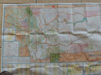
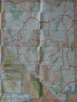
Who is still using good old fashion road maps for their travels? I would think using gps all the time would take a lot of the adventure out of the ride.
GPS now and GPS till I'm dead. I used paper maps till a few years ago saying "adventure" but when I went to the dark side and used my first GPS I was hooked. In short.....what difference does it make if you are looking at dead trees vs plastic? My thoughts
cognaccruiser
New member
We still carry paper maps and I like to refer to them in the evening during long trips. I find it helps keep things in proportion and perspective. I also like to plan trips with paper maps because they give me the bigger picture. We do carry a GPS and I do find them helpful going through busy cities for getting in the correct lanes and knowing where to turn.
GPS can also get people in a world of trouble and there have been a number of documented cases where people have gone where the GPS/smart phone has told them only to end up lost, stuck, out of gas and a number of other possible bad out comes. If they had looked at a paper map they wouldn't have in some cases died.
I like to keep a set of paper maps at home solely for the purpose of marking every road we have been on in the states and provinces that we have visited. Kind of a hobby I guess but it is fun to look at them periodically as a way to remember roads traveled.

Gary
GPS can also get people in a world of trouble and there have been a number of documented cases where people have gone where the GPS/smart phone has told them only to end up lost, stuck, out of gas and a number of other possible bad out comes. If they had looked at a paper map they wouldn't have in some cases died.
I like to keep a set of paper maps at home solely for the purpose of marking every road we have been on in the states and provinces that we have visited. Kind of a hobby I guess but it is fun to look at them periodically as a way to remember roads traveled.


Gary
PrairieSpyder
New member
I like to plan on paper or the iMap app. But it's GPS when I ryde.
safecracker
Well-known member
I use paper,Inlike.to.see the big picture versus the small scale of GPS. I do use GPS in cities.
Use both. When the GPS becomes annoying or tries to turn me into a ditch, I get the paper out.
Like toilet paper?:roflblack:
Bob Denman
New member
The GPS is my main gun, and paper maps are safely stored in the frunk as back-ups; ready to be pulled out, and never folded properly again! 
quasi
New member
For finding a specific address the gps is hard to beat. I use it in my truck for my work. I cover a good portion of the state of West Virginia doing damage appraisals. But so far haven't found a need for it on the bike. Of course I haven't been riding through New York city or anything either. Might use gps on our trip to Tennessee in June for the rally. Then again might not. thanks for all the insight.
Chupaca
New member
I have but one thing to say....
The Big Picture.......always carry paper maps they don't need batteries or electric connections etc. I also carry in the frunk a gps and have used it occasionally. What I always used was the tripkit from AAA just flip the page as you finished that leg with a fold out for big cities...:2thumbs:
The Big Picture.......always carry paper maps they don't need batteries or electric connections etc. I also carry in the frunk a gps and have used it occasionally. What I always used was the tripkit from AAA just flip the page as you finished that leg with a fold out for big cities...:2thumbs:
Kraut
Member
Who is still using good old fashion road maps for their travels? I would think using gps all the time would take a lot of the adventure out of the ride.
I agree! I use GPS to get to hotels and Restaurant on I'm near my destination. But my Navigator and my road trips are pick a direction not destination and it's nice spreading out a map on the hotel bed and pick the next days ride
Bam Bam and Pebbles
New member
I agree! I use GPS to get to hotels and Restaurant on I'm near my destination. But my Navigator and my road trips are pick a direction not destination and it's nice spreading out a map on the hotel bed and pick the next days ride
:agree: For the most part, I just ride off and I usually can figure my way back. When Pebbles rides with me, she tells me when to turn. She doesnt have a clue where we are going and either do I. She knows ill get us home no problem. Very seldom have a destination in mind. Of course, we do the same thing when in my truck.
Fat Baxter
Member
Paper maps. I fold them up a certain way, and tuck them under my sheepskin. Sitting on them keeps them in place. Every now and then, I pull over, stand up slightly on the floorboards, and pull out the map. Yes, it's a bit rough on the maps, but they're free at most Interstate rest stops.
None of my bikes have GPS. IMO, GPS tells you you are lost, with great precision. I don't want to now where I am -- I want to know where I'm going.
Besides -- I'm retired. If I get lost following a map, so what? I've got time to figure out how to get back on course.
I can -- and have -- wasted a lot of time poring over a Rand McNally road atlas of the US, state by state.
Highwayman2013
New member
I carry a smart phone with Google Maps, a GPS and paper maps. Counting on GPS alone can get you in some sticky situations.
rustynail51
Member
maps
Still go the old fashioned way, paper map, gps is ok in highly populated areas but prefer the paper when traveling cross country. Switched back after the gps insisted I turn right well, in less than fifty feet I knew someone had entered the wrong data and turned around and checked the paper.
Still go the old fashioned way, paper map, gps is ok in highly populated areas but prefer the paper when traveling cross country. Switched back after the gps insisted I turn right well, in less than fifty feet I knew someone had entered the wrong data and turned around and checked the paper.
Similar threads
- Replies
- 9
- Views
- 2K
- Replies
- 51
- Views
- 9K
- Replies
- 17
- Views
- 3K
- Replies
- 0
- Views
- 606

