• There were many reasons for the change of the site software, the biggest was security. The age of the old software also meant no server updates for certain programs. There are many benefits to the new software, one of the biggest is the mobile functionality. Ill fix up some stuff in the coming days, we'll also try to get some of the old addons back or the data imported back into the site like the garage. To create a thread or to reply with a post is basically the same as it was in the prior software. The default style of the site is light colored, but i temporarily added a darker colored style, to change you can find a link at the bottom of the site.

coloring maps?????

cruisinTX

Member
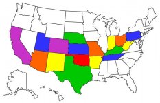
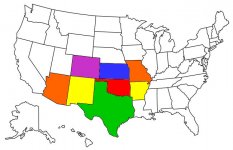
I've noticed several folks having US maps at the bottom of each post where they have been able to color code certain states. I'm guessing those are states where they have traveled on their Spyders. I tried to use a similar map several years ago on some motorcycle websites but they did not seem to be user friendly at all. I'm wondering where to access those and if they are now easier to fill in the colors than say; 15 years ago when I last tried them.
 
Thanks for the replies so far. SpyderAnn01 sent me a link that seems to be the most user-friendly source for maps I've tried. So just in case anyone else is looking give it a try.

https://visitedstatesmap.com/

I created two maps with it very quickly. One is all of the states I have traveled and the other only the 8 states I have traveled on bikes and Spyders. You would have thought with over 440K miles on bikes and ~5400 since acquiring our Spyder, I would have been in more states. hmmmmm, guess I need to work on adding to that next spring and summer :riding:
 

Attachments

  • MY LIFETIME MAP.jpg
    MY LIFETIME MAP.jpg
    54.3 KB · Views: 9
  • MY BIKE MAP.jpg
    MY BIKE MAP.jpg
    56.8 KB · Views: 8
I'd definitely say www.epgsoft.com is easier than https://visitedstatesmap.com, reason being you simply click the map to pick states, versus trying to chk boxes in a 3 column list of states.

www.epgsoft.com also allows a simple 1 click download to your computer of the image it creates (which is selctable in size & format ie jpg jpeg gif pdf), versus https://visitedstatesmap.com/ only giving you a link to an image, which you would need to navigate to via a browser, then right click to save that image to your computer, it doesnt offer any size options or format options of the pic.
 
I must be doing something wrong in the epgsoft site then. It only showed me the one size option of 198 x 100 and I could not get it to save that map anywhere in my computer. The other that I used allowed me to save with a right click directly from the image it created. It also offered four sizes from a drop down menu.
 

Attachments

  • size options.jpg
    size options.jpg
    21.6 KB · Views: 6
Click the map size when your on epgsoft, it doesnt really denote that it is a drop menu because the down arrow isnt very dark & has no box around it.

I missed the size option on your site the first time.

The chking of boxes is tedious, especially if you was on a mobile device.
 
na, I've already got them done and book marked the page in my computer, so I'll probably just stick with those. Appreciate the feedback just the same.
 
Last edited:
Oh, i was just comparing, not putting it down, just think the clicking of the map itself to select a state is much easier is all.
 
lernt a couple things thanks

me too, if my computer skills were better, the first site offered would have been sufficient. Seeing as how I never do these sorts of things in my phone though, either site works for me now that I know how to use both. :ohyea:
 
Back
Top