• There were many reasons for the change of the site software, the biggest was security. The age of the old software also meant no server updates for certain programs. There are many benefits to the new software, one of the biggest is the mobile functionality. Ill fix up some stuff in the coming days, we'll also try to get some of the old addons back or the data imported back into the site like the garage. To create a thread or to reply with a post is basically the same as it was in the prior software. The default style of the site is light colored, but i temporarily added a darker colored style, to change you can find a link at the bottom of the site.

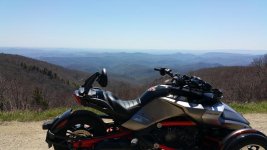
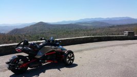
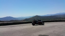
Blue Ridge Day Ride.

That is a nice ride. I have been to all over that area. Just check to be sure that non of the BRP will be closed. We were going to take the BRP from Asheville to Mt. Mitchell in February, but part of it was closed due to some bridge construction. Keep in mind that it can snow on Mt. Mitchell at any time. You will enjoy hwy 80. If you have time, take a trip around 226A (I think it is called Diamondback). Very curvy, but smooth road.
 
That is a nice ride. I have been to all over that area. Just check to be sure that non of the BRP will be closed. We were going to take the BRP from Asheville to Mt. Mitchell in February, but part of it was closed due to some bridge construction. Keep in mind that it can snow on Mt. Mitchell at any time. You will enjoy hwy 80. If you have time, take a trip around 226A (I think it is called Diamondback). Very curvy, but smooth road.

Thanks for the input. Looking forward to testing out Ron's swaybar...
 
That is a nice ride. I have been to all over that area. Just check to be sure that non of the BRP will be closed. We were going to take the BRP from Asheville to Mt. Mitchell in February, but part of it was closed due to some bridge construction. Keep in mind that it can snow on Mt. Mitchell at any time. You will enjoy hwy 80. If you have time, take a trip around 226A (I think it is called Diamondback). Very curvy, but smooth road.


I see that 226A now..
 
Closed portion of BRP

The BRP is completely closed to any traffic for road and tunnel work between Mile Post 364.1 and 375.6 until summer. Just checked it for a ride I'm doing with 4 other guys last week of May just before Memorial Day. In our case, we are taking the Auto Train out of Sanford, FL to Lorton, VA Going over to Front Royal and taking Skyline Drive to the BRP all the way to Cherokee. Then through Maggie Valley and stopping at "Wheels Through Time" and then to Greenwood, SC for overnight. Next to Savannah or Waycross , GA for the next overnight and then back to Deland , FL. Hoping for an enjoyable 7 days. First long trip on the RT Ltd. We leave on the Train on May 21 and get back home on May 28.:yes::yes::yes: :yes::yes:
 
The BRP is completely closed to any traffic for road and tunnel work between Mile Post 364.1 and 375.6 until summer. Just checked it for a ride I'm doing with 4 other guys last week of May just before Memorial Day. In our case, we are taking the Auto Train out of Sanford, FL to Lorton, VA Going over to Front Royal and taking Skyline Drive to the BRP all the way to Cherokee. Then through Maggie Valley and stopping at "Wheels Through Time" and then to Greenwood, SC for overnight. Next to Savannah or Waycross , GA for the next overnight and then back to Deland , FL. Hoping for an enjoyable 7 days. First long trip on the RT Ltd. We leave on the Train on May 21 and get back home on May 28.:yes::yes::yes: :yes::yes:


Man that sounds like an awesome ride! Thanks for the heads up, looks like I will be jumping off the BRP just in time. NPS site says 367.5 - 375.6 closed for tunnel repair, projected opening date April 15th
 
Is there a way for me to know what the mile marker numbers are? I have a trip planned for Mt. Mitchell on 4/21-4/24. I would like to take 80 up to the BRP, then go to Mt. Mitchell, and then take the BRP back down to I-40 into Asheville.
 
Mile Markers

Is there a way for me to know what the mile marker numbers are? I have a trip planned for Mt. Mitchell on 4/21-4/24. I would like to take 80 up to the BRP, then go to Mt. Mitchell, and then take the BRP back down to I-40 into Asheville.


Google Blue Ridge Parkway and there is a map that prints on 4 letter size pages with indicators every 10 miles. You can also print a list they have of where gas is located. You should be able to find it. If not you can PM me with your email address and I will scan them and end to you.
 
IMO, U.S. 321 is dull out of the mountains. Suggest:
U.S. 64 from Lenoir to Morganton
NC 18 south out of Morganton to
Right on Old NC 18 (lots of twisties) to where it rejoins NC 18 just north of Halfway Supply.
NC 18 SW to Left on NC 27, then
Right on Shoal Rd @ West Lincolnton High School
Left on Crouse Rd.
Cross NC 150 at stoplight
Right on Gaston-Webbs Chapel Rd.
Right on Landers Chapel Rd.
Left on Long Shoals Rd. and 1st Right on High Shoals Rd.
Right on Ike Lynch Rd. (Becomes Hardin Rd. @ Bus 321)
Right on U.S. 321 and south to Gastonia.
 
The BRP is completely closed to any traffic for road and tunnel work between Mile Post 364.1 and 375.6 until summer. Just checked it for a ride I'm doing with 4 other guys last week of May just before Memorial Day. In our case, we are taking the Auto Train out of Sanford, FL to Lorton, VA Going over to Front Royal and taking Skyline Drive to the BRP all the way to Cherokee. Then through Maggie Valley and stopping at "Wheels Through Time" and then to Greenwood, SC for overnight. Next to Savannah or Waycross , GA for the next overnight and then back to Deland , FL. Hoping for an enjoyable 7 days. First long trip on the RT Ltd. We leave on the Train on May 21 and get back home on May 28.:yes::yes::yes: :yes::yes:

Bobleach

I live about 3-1/2 miles from the BRP about mile marker 215 onto route 89. Holler if you have time. Check out Grand Father Mt.
 
IMO, U.S. 321 is dull out of the mountains. Suggest:
U.S. 64 from Lenoir to Morganton
NC 18 south out of Morganton to
Right on Old NC 18 (lots of twisties) to where it rejoins NC 18 just north of Halfway Supply.
NC 18 SW to Left on NC 27, then
Right on Shoal Rd @ West Lincolnton High School
Left on Crouse Rd.
Cross NC 150 at stoplight
Right on Gaston-Webbs Chapel Rd.
Right on Landers Chapel Rd.
Left on Long Shoals Rd. and 1st Right on High Shoals Rd.
Right on Ike Lynch Rd. (Becomes Hardin Rd. @ Bus 321)
Right on U.S. 321 and south to Gastonia.

Are you talking about the way back? I was planning on a counter-clockwise route. My thoughts were, (since it's a long ride), to start out early enough to get up to blowing rock so I can take more time for the rest of the route..
 
That is a nice ride. I have been to all over that area. Just check to be sure that non of the BRP will be closed. We were going to take the BRP from Asheville to Mt. Mitchell in February, but part of it was closed due to some bridge construction. Keep in mind that it can snow on Mt. Mitchell at any time. You will enjoy hwy 80. If you have time, take a trip around 226A (I think it is called Diamondback). Very curvy, but smooth road.

Did it yesterday. Awesome day. 80 degrees, not a cloud in the sky. The diamond back was awesome, and so was hwy 80, thanks for that.
attachment.php
attachment.php
attachment.php
 

Attachments

  • 20160418_123820.jpg
    20160418_123820.jpg
    45.2 KB · Views: 108
  • 20160418_132859.jpg
    20160418_132859.jpg
    53.5 KB · Views: 105
  • 20160418_132918.jpg
    20160418_132918.jpg
    42.1 KB · Views: 105
Back
Top