• There were many reasons for the change of the site software, the biggest was security. The age of the old software also meant no server updates for certain programs. There are many benefits to the new software, one of the biggest is the mobile functionality. Ill fix up some stuff in the coming days, we'll also try to get some of the old addons back or the data imported back into the site like the garage. To create a thread or to reply with a post is basically the same as it was in the prior software. The default style of the site is light colored, but i temporarily added a darker colored style, to change you can find a link at the bottom of the site.

2016 Lower 48, No Interstate Tour

chetandmarj

New member
Fellow Spyder Lovers...we thought you might be interested in our summer trip plans. We have been planning a 3 month motorcycle trip this summer we are calling “2016 Lower 48, No Interstate Tour” to celebrate our 25th wedding anniversary. We will be visiting all 48 states (and the District of Columbia) on our Can-Am Spyder RT. The entire trip as currently planned is 72 days and over 16,000 miles, all without traveling a single mile on an interstate.

We plan to depart on May 12[SUP]th[/SUP] from our home in High Rolls, NM. Our first stop will be San Antonio, NM to have a green chile cheeseburger at the Owl Bar and Café…one of our favorite spots. We also enjoy geocaching and plan to find at least one geocache in each state we visit. We created a NM themed poker chip as trading swag and a trading card to share with folks we meet along the trip.

As we have talked about this trip over the years, several of our family and friends have said…”you need to post that on Facebook” or “you should write a blog about the trip”. So, we created a Facebook page and Blog to share with all of our family and friends.

You can check them out here:
– Facebook: http://www.facebook.com/L48NI
– Blog: http://www.L48NI.wordpress.com

We plan to use the Facebook page as more of a picture album and the Blog as more of a diary to document our journey, so you might want to check them both out. We have links from one to the other, so it’s easy to go back and forth. We know many of our friends and family don’t “do Facebook”, so we set it up as a business page that doesn’t require you to be “on Facebook” to view it.

We will periodically post updates here on the Spyder Lovers forum as well.

Feel free to start following us on one or both of the pages. We will be posting some updates as we get ready for the trip. Both are public pages, so feel free to share it with others you think might enjoy it.

On the blog, you can click on the “Follow” link in the bottom right corner.

  • Just enter your email address and click on “Sign me up”.
  • You will get an email asking you to Confirm your subscription.
  • Click on the “Confirm Follow” link in the email.
  • It should take you to Wordpress.com and give you a message that you have Successfully updated your subscription.
  • You will get one more email with the subject “Confirmed Subscription to Posts on Lower 48, No Interstate”.
  • That’s it, after that you will get an email when we post something to the blog.

Hope you enjoy following us as much as we will enjoy being on the trip!

5 Days and counting…..:yes:
 
Welcome

Sounds like quite an adventure! You must have several stops or layovers programmed in; 16000/72=222 miles a day. Our NTA trip was 9000 miles in 26 days. We had a 5 day layover in Anchorage, and 2 days in Mukluk. We did easy 450 mile days. I think it will be epic! Enjoy the ride!! Cheers!
Joe
 
Wow...!!

sounds amazing....let me find a company that will give me 3 months vacation...:roflblack: wait I'm retired...but can't afford to be...:roflblack: hope you have a wonderful trip and keep sending us updates on your progression. If you hit some places we're at we could ryde along with you a bit..:thumbup::thumbup:
 
Happy for you:congrats:Enjoy lots to see out there:thumbup: are you gonna join the IBA as the trip will qualify on few levels
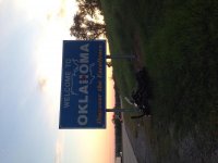
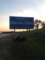
http://ironbutt.com/ridecerts/:firstplace:. Also however fyi (i found out hard way) some signs are along interstate only
attachment.php
namely as i traveled up from TX & back from AR , nice roads but no welcome sign:banghead: something i am working on for personal collection.
 

Attachments

  • image.jpg
    image.jpg
    46.7 KB · Views: 296
ffy,

Happy for you:congrats:Enjoy lots to see out there:thumbup: are you gonna join the IBA as the trip will qualify on few levels
http://ironbutt.com/ridecerts/:firstplace:. Also however fyi (i found out hard way) some signs are along interstate only namely as i traveled up from TX & back from AR , nice roads but no welcome sign:banghead: something i am working on for personal collection.


attachment.php
 

Attachments

  • f1.jpg
    f1.jpg
    26.9 KB · Views: 283
... Also however fyi (i found out hard way) some signs are along interstate only ...

We were able to find welcome signs on most side roads. One thing that helped us to have advance warning of where the signs were was doing a bit of internet recon. While using Base Camp and having Google Earth running, I would put a waypoint at the border as indicated on the map, then (with that point selected) went to the menu bar and selected View/Google Earth/Selected Items. Google Earth will go to the location and if you zoom all the way in you will be in street view. Then I would search around the area until I found the sign. If the sign was not right at the border I would use the coordinates from Google Earth to move the waypoint to the actual location, including whether it was on the right or left of the roadway.

You can also use street view while in Google maps to get the same information.
 
Boy, I'm jealous. This is something I have been working on a long time. Trying to visit all lower 48 states. My approach has been nothing like you have planned. Mine is taking a trip which includes adding a few states at a time which were done while riding a bike. As you can see from my states map, I have quite a few more to see. Want to wish you a safe and enjoyable ride and if you get over my way, it would be a privilege to ride a few miles with you both.
 
We were able to find welcome signs on most side roads. One thing that helped us to have advance warning of where the signs were was doing a bit of internet recon. While using Base Camp and having Google Earth running, I would put a waypoint at the border as indicated on the map, then (with that point selected) went to the menu bar and selected View/Google Earth/Selected Items. Google Earth will go to the location and if you zoom all the way in you will be in street view. Then I would search around the area until I found the sign. If the sign was not right at the border I would use the coordinates from Google Earth to move the waypoint to the actual location, including whether it was on the right or left of the roadway.

You can also use street view while in Google maps to get the same information.

Excellent advice! We do a lot of geocaching and have used that to find signs as well. If there is a sign, there is usually a geocache nearby. There are a few that we have not been able to confirm the location of the sign, we will definitely use your suggestion on those to verify if a sign is on our route.
 
Sounds like quite an adventure! You must have several stops or layovers programmed in; 16000/72=222 miles a day. Our NTA trip was 9000 miles in 26 days. We had a 5 day layover in Anchorage, and 2 days in Mukluk. We did easy 450 mile days. I think it will be epic! Enjoy the ride!! Cheers!
Joe

Yeah, we wanted to enjoy the ride AND the destination so we are shooting for no more than 350 miles a day. We have a couple of days to layover in Grand Marais, MN, Pittsburgh, PA and Yellowstone. Wanted to build some buffer in for bad weather as well.
 
Congrats on your 25th Wedding Anniversary! Have a safe trip, and enjoy your trip in lower 48 states. Deanna
 
Have you put a map together yet, and is it sharable? I'd love see what your route looks like if you have one.
 
We were able to find welcome signs on most side roads. One thing that helped us to have advance warning of where the signs were was doing a bit of internet recon. While using Base Camp and having Google Earth running, I would put a waypoint at the border as indicated on the map, then (with that point selected) went to the menu bar and selected View/Google Earth/Selected Items. Google Earth will go to the location and if you zoom all the way in you will be in street view. Then I would search around the area until I found the sign. If the sign was not right at the border I would use the coordinates from Google Earth to move the waypoint to the actual location, including whether it was on the right or left of the roadway.

You can also use street view while in Google maps to get the same information.
Congrats & lot more planning than I put into my trips :) glad works for you. Enjoy
 
Nor-cal

If you make it to Northern California look up the SRA Sacramento and check out our group rydes. We would love to have you join us. Srasacramento.com. Or you can find us on meetup.com as well. Enjoy your trip!
 
USA TOUR

My home has always been open to Spyderlovers at all times ( ask anyone :roflblack: there's been a few ). Soooooooooooooo you to are also welcome to spend the night or longer my zip is 05660 to give you a general idea ...........PM me if you are interested........Mike :bbq:
 
Back
Top