• There were many reasons for the change of the site software, the biggest was security. The age of the old software also meant no server updates for certain programs. There are many benefits to the new software, one of the biggest is the mobile functionality. Ill fix up some stuff in the coming days, we'll also try to get some of the old addons back or the data imported back into the site like the garage. To create a thread or to reply with a post is basically the same as it was in the prior software. The default style of the site is light colored, but i temporarily added a darker colored style, to change you can find a link at the bottom of the site.

Zumo 590 discontinued

I was just wondering for those that might want a GPS option and not the smart phone app why BRP is selling or at least showing a discontinued GPS on the build page for the 2018?
 
I got mine for 524.99 Referbished in the Garmin outlet store. Everything is just like new. I have since seen them advertised for under 500. Lamonster sells the mount you need for 124.00
 
Yes but Garmin have released the Zumo 595 which is virtually identical. There has just been some software improvements, namely:

  • Curvy roads yes/no option replaced with a slider to say how off-route your willing to go to get them.
  • Spotify interface (previously just had Pandora)
  • Live Track - via mobile phone, now people can see where you are real-time (don't know if that's a good thing)
  • 3D terrain view

Hardware is the same, so the mounting kit etc will still work if you have the 590 ones.

I've just got a replacement battery for my 590 that said it was for a 595 so those are compatible. Battery last longer, perhaps half an hour off-bike. Mind you the 590 batteries were terrible - even new mine only lasted 5 minutes.
 
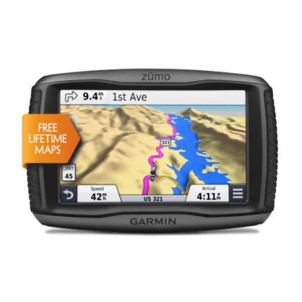
Besides waterproof, why would you buy a Zumo?

In my case when I purchased it the waterproofing that was the main factor.

However the key factor in use has turned out to be the interface is designed to work with motorcycle gloves on. Can't underestimate how much better this is over a phone/car gps (I tried both before getting the 590)

Its tougher than a normal GPS and its supposed to handle vibration etc. etc better.
I've dropped mine a couple of times with no ill effects and I do ride on gravel roads that have caused vibration damage to other bits of my Spyder.

There's quite a few useful for biker features. E.g. it has landscape and portrait mode and I've found portrait is better on a bike.

There is the 'Curvy Road' setting that will try and find you routes that a better for motorbikes, though I'm not so fond of this as I find it sometimes gets carried away and most roads in NZ are bike friendly anyway. I suspect in countries with more multi-lane highways this feature would be more useful, South Island NZ probably only has only has 10km worth:-)

Stopping the device replanning your routes when you copy them over from Basecamp can be frustrating, but that's the same with every Garmin device.

If you have a multi-point route it doesn't make much of a visual fuss with you get to one of your points, so if like me you use it without the sound then its easy to miss them and keep riding (very frustrating if your doing a photo checkpoint rally). I've got around this by creating separate routes between each checkpoint rather than one continuous route. This is a problem I've had with every GPS device I've used.


Last edited:
Do the 18s have a GPS connection cable as part of the wiring harness?
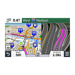
It doesn't look like it. The only GPS discussion on the videos is in relation to BRP Connect compatible smartphone apps. A search of the owner's manual gets zero hits for 'GPS' and no reference to any kind of GPS cable with a search on 'cable'. It may be possible to feed a GPS signal in via Bluetooth by selecting music input. If you have a GPS device that also plays music with GPS overriding the music feed then that would probably work. But to listen to AM or FM radio over the bike radio and have a GPS audio come in over top of them doesn't look like an option as I see things.
 
My Zumo 550 still works. It does what it does turn by turn directions. I also use a Garmin GPSMAP 76CXS for watching the moving map while on the Spyder.
 
I was just wondering for those that might want a GPS option and not the smart phone app why BRP is selling or at least showing a discontinued GPS on the build page for the 2018?


I believe that the CB is not being offered at all......and the GPS functionality will be provided by the new cell phone integration app.
Some say that the Bluetooth replaces the CB......but it's not the same.
 
Here is why I was asking why they are selling a discontinued model

Under build your spyder for 2018 in the electrical accessories section they have:

GPS SUPPORT FOR TRI AXIS ADJUSTABLE HANDLEBAR
219400616
$ 229.99

ADD THIS ACCESSORY

[FONT=TradeGothicLTStd, Helvetica Neue, Helvetica, Arial, sans-serif]Support for Garmin Zumo 590 GPS. Rotates to suit multiple adjustable handlebar settings. Includes casting, electric harness, rubber boot and hardware. GPS sold separately.[/FONT]


[FONT=TradeGothicLTStd, Helvetica Neue, Helvetica, Arial, sans-serif]and[/FONT]

ELECTRICAL & ELECTRONICS
GARMIN† ZUMO† 590 GPS
219400512
$ 799.99

ADD THIS ACCESSORY

[FONT=TradeGothicLTStd, Helvetica Neue, Helvetica, Arial, sans-serif]Glove-friendly and sunlight-readable 5” (12.7 cm) dual-orientation touchscreen display with Bluetooth® 5 technology. Allows control of music right on the display. Rugged and tough enough to withstand fuel spills, UV rays and harsh weather. Free lifetime map updates and Curvy Road routing. GPS holder sold seperately.[/FONT]

[FONT=TradeGothicLTStd, Helvetica Neue, Helvetica, Arial, sans-serif]but on the garmin site


[/FONT]AUTOMOTIVE
DISCONTINUED


  • cf-lg.jpg
  • rf-lg.jpg
  • lf-lg.jpg
  • pd-01-lg.jpg
  • pd-02-lg.jpg
  • pd-03-lg.jpg
  • sc-01-lg.jpg
  • sc-02-lg.jpg
  • sc-03-lg.jpg
  • sc-04-lg.jpg

[h=1]zūmo® 590LM[/h][h=3]PART NUMBER: 010-01232-01[/h]
$799.99USD


FIND A DEALER
[FONT=&quot]


[/FONT]
[h=1][/h]
 
I was just wondering for those that might want a GPS option and not the smart phone app why BRP is selling or at least showing a discontinued GPS on the build page for the 2018?
You can't completely trust the build page. They also show the iPod and mp3 player cables in the accessories list. If you go to the general accessories catalog you'll see those two items are for the RT, 2015 and earlier. Not needed for 2016 and later.
 
I have remarked before about BRP's terrible catalog marketing information. They just don't seem capable of getting all their :cus: together in one bag. In this case I typed in the part number for the Zumo 590 that showed in the online catalog as a RT accessory and when the results came up it said it was the GPS, for the F3 -- period, nothing about the RT.
 
......

Stopping the device replanning your routes when you copy them over from Basecamp can be frustrating, but that's the same with every Garmin device.......


Without meaning to hijack the essence of this thread, the above partial comment accurately reflects the frustration I am having. I'd be very grateful if some of you with the experience I lack can tell me what I'm doing wrong.

I have a 2017 F3L, equipped with a Zumo 590 bought from BRP. I'm trying to learn route planning. I am rather 'technically challenged' when it comes to modern electronic devices, it seems. I'm not great with a computer, and often fight with cell phones. My problem is:

I like to plan wandering, curvy, back country routes on my laptop computer using Google Maps. When I finally get something I like, I convert to GPX using GPS Visualizer. I then record/store in BaseCamp, from which I can then transfer to the Zumo. Seems to be a complicated process, but I gather that's what I have to do. HOWEVER, when I get on the Spyder, switch on the Zumo and select my appropriate saved file, the damn Garmin re-plans my route, changes all my chosen back roads to super highways and tries to send me exactly where I do NOT want to be. Frustrating as Hell, and a total piss off! Not to mention all the wasted time spent planning.

So, how do I over-ride the Garmin's tendency to take over and un-plan my route? So far, I just ignore the 'lady in the sky' that keeps 'recalculating' for me. I must have heard her a zillion times; she's another electronic nemesis, of which I have more than my share.

Helpful direction much appreciated. Thank you.
 
Last edited:
Hi billythekidd,

As mentioned Garmin have replaced the 590 with the 595 which is the same unit with a few software enhancements (as listed above). 590 wiring kits etc will work with the 595 (and I'm guessing probably the 395 though I've not confirmed that).

So that just means either:
  • BRP haven't updated their web site but will actually supply the 595 if you order one.
  • or, BRP have some old 590 in stock and want to get rid of those before selling 595s.

If you buy the 595 direct from Garmin then it does come with a stock mount and wiring harness. The stock mount has a ram fitting so it's simple to find a suitable bracket for the Spyder.
 
Without meaning to hijack the essence of this thread, the above partial comment accurately reflects the frustration I am having. I'd be very grateful if some of you with the experience I lack can tell me what I'm doing wrong.

I have a 2017 F3L, equipped with a Zumo 590 bought from BRP. I'm trying to learn route planning. I am rather 'technically challenged' when it comes to modern electronic devices, it seems. I'm not great with a computer, and often fight with cell phones. My problem is:

I like to plan wandering, curvy, back country routes on my laptop computer using Google Maps. When I finally get something I like, I convert to GPX using GPS Visualizer. I then record/store in BaseCamp, from which I can then transfer to the Zumo. Seems to be a complicated process, but I gather that's what I have to do. HOWEVER, when I get on the Spyder, switch on the Zumo and select my appropriate saved file, the damn Garmin re-plans my route, changes all my chosen back roads to super highways and tries to send me exactly where I do NOT want to be. Frustrating as Hell, and a total piss off! Not to mention all the wasted time spent planning.

So, how do I over-ride the Garmin's tendency to take over and un-plan my route? So far, I just ignore the 'lady in the sky' that keeps 'recalculating' for me. I must have heard her a zillion times; she's another electronic nemesis, of which I have more than my share.

Helpful direction much appreciated. Thank you.

This is so frustrating isn't it:-) I can't promise you I've completely solved it but I have made some headway.

I'll write up some notes for you and post them here a bit later (on the wrong computer at the moment)
 
Without meaning to hijack the essence of this thread, the above partial comment accurately reflects the frustration I am having. I'd be very grateful if some of you with the experience I lack can tell me what I'm doing wrong.

I have a 2017 F3L, equipped with a Zumo 590 bought from BRP. I'm trying to learn route planning. I am rather 'technically challenged' when it comes to modern electronic devices, it seems. I'm not great with a computer, and often fight with cell phones. My problem is:

I like to plan wandering, curvy, back country routes on my laptop computer using Google Maps. When I finally get something I like, I convert to GPX using GPS Visualizer. I then record/store in BaseCamp, from which I can then transfer to the Zumo. Seems to be a complicated process, but I gather that's what I have to do. HOWEVER, when I get on the Spyder, switch on the Zumo and select my appropriate saved file, the damn Garmin re-plans my route, changes all my chosen back roads to super highways and tries to send me exactly where I do NOT want to be. Frustrating as Hell, and a total piss off! Not to mention all the wasted time spent planning.

So, how do I over-ride the Garmin's tendency to take over and un-plan my route? So far, I just ignore the 'lady in the sky' that keeps 'recalculating' for me. I must have heard her a zillion times; she's another electronic nemesis, of which I have more than my share.

Helpful direction much appreciated. Thank you.

Why Does It Change?
Firstly, GPX files don’t store your exact route, rather they store the start and end points and some points along that. Every vendor stores a different amount of information for routes. When you load that GPX file into Basecamp or transfer a route to your 590 it’s going to recalculate from the information provided and this is where the changes creep in.

Now personally I can understand this a bit going from Google to Basecamp, after all there are bound to be little differences in the maps. But it’s very frustrating that it also happens when its transferred to the 590.

Google Maps and Basecamp

Like you I far prefer Google Maps over Basecamp for planning routes. Google Maps is modern and easy to use, while Basecamp feels like it was designed in the 1990’s.

I’ve now forced myself to use Basecamp to plot my routes, even if I refer to Google Maps while doing so, just to take that one conversion out of the equation.

Its not problem to continue to use Google Maps and transferring to Basecamp, but just carefully check the route after you’ve done so and add the Shaping Points discussed below.

Shaping Points
One nice feature of Google Maps is that, if you don’t like the roads it chooses, you can just drag a route over onto another road and it will re-plan everything automatically for you. However, this is exactly the sort of change that’s lost during the transfers.

The big trick with Basecamp is to add shaping points to your route, these help stop your route being changed. If you look at picture below I’ve got a simple route between two places:
2018-01-25_23-34-23.jpg

If I wanted to go the longer route I add one or more points on the other road to shape my route. There's a couple of ways to do this, you can either:

  • Right click on the existing route, choose "Insert into Route" and drag the 'dot' to the other road.
  • Or; on the other road right click at a midway point and select "New Waypoint", then add that waypoint to you route between your start and finish point.
Out of the two I find the second approach tends to be more reliable. Either way I end up with something like this:

2018-01-25_23-41-46.jpg

Now you’ll get an alert when you get to that point which is a bit pointless. But what you can do is tell Basecamp this is just a shaping point. To do that open your route, right click on the point and select "Don't Alert on Arrival (shaping point)" from the menu:
2018-01-25_23-44-03.jpg

The route will now go the roads you want, and this should help the route remain unchanged when you copy it to the Garmin. I often find I need to add several shaping points like this on longer routes but this is the key way to keep the route you want.

The trick is to add these shaping points in places where any other route would be far longer, that's why in my example I added it to the middle of that other road.

Device Transfer Settings
Make sure your 590 is connected to your computer. Then In Basecamp go to the "Edit" menu and select "Settings".

Click on "Device Transfer" if not already selected, then untick:
  • Strip shaping points from routes on transfer to device
  • Always match route to the map on my device when transferring
  • Simplify tracks by removing intermediate points
Once you’ve unticked these click Ok.

Its those first two that can really muck your routes up even if you’ve used shaping points when you transfer them. That top option in particular seems really stupid to me.

Map Versions
It is important that the map your using on your 590 is the same version as the one being used by Basecamp. To make sure this is the case, connect you 590 and then go to the "Maps" menu at the top it should list the map loaded on your 590 and the one in the software with the versions.

If they are different then its normally the computer that’s out of date and you use Garmin Express software to fix that as follows:

If you go into Garmin Express and it says "Map Update Available" don’t just click on Install. Instead select "View Details", select "Installation Options", select "Computer and Device", and finally click "Install"

If instead in Garmin Express says "You're up to date", click "Map Options" and then "Install on Computer".

One other issue with Basecamp is that it keeps all the old versions of maps on your computer and its easy to have the wrong version selected, again check this in the "Maps" menu.

Activity Profiles
In Basecamp in the toolbar at the top there is a dropdown menu for the Activities.

Select the Motorbiking one, then open the menu again and select "Edit Activity Profiles…". Click on the Routing tab.

In your case it may be worth playing a bit with the Avoidance stuff. For me the Road Type Avoidance is a bit pointless because though Garmin maps marks roads as Interstates, State Highways etc. in NZ they are all very similar:-) The only one I turn on is Unpaved Roads.

Route Preference is also important. In theory the “Curvy Roads” option seems just the thing, however I’ve found it sometimes takes be some very silly routes - in one case taking me on a 5km loop to get 100m further down the road I was on. I tend to put it on Faster Time or Shorter Distance and then use shaping points to make it use the roads I want.

Once you’ve set everything click Ok.

You then need to make sure when your 590 is configured to use the same profile. Just to warn you that the profile can chance when you connect it to your Spyder, to change it to the correct profile click on the car/bike icon at the top of the screen.

Also, while you’re on the 590:
  • Go to Settings >> Map & Vehicle >> myMaps and make sure the map ticked is the right one (if you have more than one).
  • Go to Settings >> Navigation and set the Calculation Mode, Avoidances etc.
You'd think these settings would be the same at Basecamp and copy over but as you'll see they don't quite match.

Hopefully that's of some help, no guarantees though:-)

Thanks,

Jos
 
Last edited:
Here is a good link to learning how to use Garmin BaseCamp which is not a very user friendly program IMO.
http://www.newenglandriders.org/GPS/Learn_BaseCamp_PC.pdf

One of the things I tried on a long return trip home from out west last fall was to create waypoints in BaseCamp at each intersection en route from point A to point B, including A and B as waypoints. I then created the route by just inserting the waypoints in order and the route worked perfectly when uploaded to my 590.
 
New BFF's

WOW!!!
THANK YOU so much, to PistonBlown, for taking all that time to compose such a detailed explanation. I'm working hard to absorb it, and clearing the mud from my little gray cells. Your efforts at educating me are fantastic. I even managed to make myself a hard copy in print so I can have your instructions beside me as I work through on computer and Zumo.

And also, JayBros, for the kind pointers.

Once again the helpful members on this great site have reached out to rescue a lost newbie who is extremely grateful.

Cheers,
Roger
 
Last edited:
Helpful direction much appreciated. Thank you.

For starters, you need to visit the settings, route options and tell it to AVOID highways and toll roads, etc.
While there, set it for "motorcycle".
Might be another setting for "twisty scenic" roads too.

I can't help with the loading of pre-planned routes; I've never done that.

I have found, however, that with the proper settings it does a pretty good job of going where I had planned to go.

And ALWAYS with using a GPS, the driver must be somewhat familiar with the preferred route to avoid letting it talk you into stupid roads.
 
Back
Top