• There were many reasons for the change of the site software, the biggest was security. The age of the old software also meant no server updates for certain programs. There are many benefits to the new software, one of the biggest is the mobile functionality. Ill fix up some stuff in the coming days, we'll also try to get some of the old addons back or the data imported back into the site like the garage. To create a thread or to reply with a post is basically the same as it was in the prior software. The default style of the site is light colored, but i temporarily added a darker colored style, to change you can find a link at the bottom of the site.

Solo to Alaska

June 18th
Minot, ND to Swift Current, SK

I don’t know that I see every roadkill carcass on the road, but I smell most of them.

I went to bed early last night thinking that would give me more time to sleep if my body needed it. Instead, I woke up an hour early at 5 am. I dinked around the hotel then decided I might as well get on the road. So, I left Minot at 7 am. I had a lovely morning to begin riding. It was an easy route, just follow highway 52 for about 95 miles to Portal, ND where I would cross the Canadian border. Nice scenery along the way. I wonder about old buildings and what their history may be?
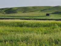
20220618_073934.jpg

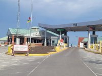
In Portal, I topped off my gas tank one last time with USA prices and proceeded to the border crossing.
20220618_074950.jpg

It was a smooth and easy crossing. I had read I would need my Passport, my immunization card showing two vaccinations and an e-mail receipt showing the completion of the ArriveCan app. The border guard only asked to see my Passport, no mention of the immunizations or app. He asked me several questions and I was on my way.

I could not find the “Welcome to Saskatchewan” sign located somewhere at the border crossing. As I was looking for it, I ended up on a side road back to US border. I didn’t want to end up there, but it was on a one-way only street. I turned around and zipped against the one-way road and on into Canada. In Canada for ten minutes and I’m already breaking laws. Also, I had not thought about Canada NOT being on Daylight Savings Time. I gained an hour. With the hour I gained from leaving Minot early I was now 2 hours ahead of schedule. No wonder the Canadian border was so quiet, it was 7:30 in the morning.
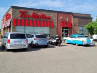
I made my first stop in Weyburn. Since I missed the welcome sign, I needed my first picture to be something iconic. It didn’t take long for a Tim Hortons to show up. For those unfamiliar with Tim Hortons, they are like a Dunkin Donuts only everywhere like a Starbucks in the States but the Canadians seem to LOVE Timmy’s. It was about 10 am on a Saturday morning and the drive thru was packed.
20220618_093532.jpg

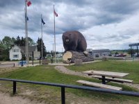
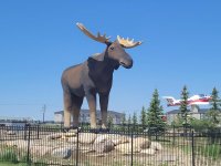
I continued to Moose Jaw, SK. I love original names. I needed gas before I proceeded to Swift Current on the Trans-Canada Highway and found this guy.
20220618_121857.jpg

“Mac” is the largest moose in the world. There has been some competition between Moose Jaw and a town in Norway for the biggest moose but as of today, the honor goes to Moose Jaw.

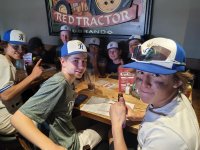
On Canadian Highway 1 or the Trans-Canada Highway, I was able to open it up to 110 kilometers an hour. That is roughly 70 miles an hour. I’ve kept my Spyder odometer on miles and I refer to my phone’s gps for kilometer equivalent. The temperature had risen during the day. A lady in Moose Jaw lamented that her kid had wanted to see the moose on the hottest day of the year. My motel had early check-in at 3 pm so I flopped on the bed, rested and cooled off for a bit before I went out for dinner. At the bar and grill I was eating at I noticed some young baseball players. I had to go over and say hello since they are the Royals and I’m from the Kansas City area. One of them had visited KC a few years ago and saw the Royals play the Toronto Blue Jays. They are taking the KC Royals poor season in stride as they too, alas, are not doing well.
20220618_174952.jpg

After a double cheeseburger and a tall blonde ale I called day 3 done and headed back to the hotel for the night.
 
June 19th,
Swift Current to Calgary

Today is my shortest day of the trip so far. Only a 5-hour drive time ride. However, rain started overnight and is forecast to continue throughout the day all the way to Calgary. I went to bed hearing about thunderstorms, so I was a little uneasy about my day. I don’t mind riding in the rain, but torrential downpours are never fun. I had a little more time in my day to adjust my departure time but there were no good windows of opportunity.

I work up early again and saw it was raining at 5 am. It was a steady, gentle rain so I decided to go for it. I looked up the radar and saw spacing between two main systems located in my direction and hoped I could ride in this sweet spot for a while. Turns out, the wettest I got was the first 20 minutes heading out of Swift Current.

Surprisingly, I was able to stay out of the rain most of the day. I would see the highway heading to a rain burst in the distance, but the storm would move northerly and would be off the highway as I approached it. This happened a couple times. The roads would be wet and damp, but I could easily keep my speed at 110 kph.

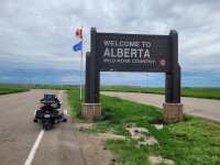
This was mainly a slab day, so I didn’t have much to take pictures of. I pulled over at a rest stop where the Alberta sign was located. The rest stops I encountered are only pit toilets and not for the faint of heart.

20220619_084728.jpg

Tomorrow, I’ll make up for the lack of pictures as I ride through Banff and Jasper National Parks. It is supposed to be an overcast day, but I’ll keep the camera on my phone snapping!
 
Last edited:
Greta trip report. Keep the updates coming. I'm putting my trip on the Classic GW forum. This is where I have put my trips so far. Will post forum site page for the inmates. Made it across without a problem except that there was a lot of rain and wind. Supposed to get better this week. Safe riding.
 
Love the Timmies reference as I'm from near Edmonton. Also, it sounds like you dodged a bullet weather-wise on your trip from Speedy Creek (Swift Current as it often called) to Calgary.
 
Looks like an overcast morning in Banff with rain in the afternoon. Not a great day but I'll see what I can get done. One advantage with the rain yesterday is I didn't have to clean bug splatters off the windshield. Yesterday I saw a sign in eastern Alberta that said "Rural Crime Watch Area" I looked around for several square miles, there wasn't a house, a barn or silo in sight. Nothing to steal or vandalize. The area`s crime stats must be pristine!

Red - how is your trip east going?
 
June 20th
Calgary to Hinton, by way of Banff and Jasper

I’ll break this day into different postings to make it more manageable to read and upload.

Today was an eventful day. I would still be traveling for the day but there would be things to see and do along the way. If I had to do it over, I would have traveled a little further west of Calgary for the night. It turns out I still had an hour and a half drive to Banff National Park. I was up and out the door to a cool 45 F degree day. It was a little chilly and I finally stopped and put on another layer before I reached Banff. Joyfully, the rain that was called for did not materialize. It was cloudy, cool and overcast for the morning, but it only rained on me for about ten minutes when I was on my Johnston Canyon hike.
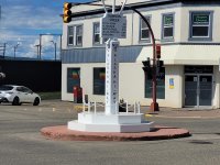
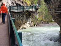
Since it was still a travel day, I had to be selective with what I would see and do in Banff. I’m sure the city of Banff is charming, but I did not have time to stroll and shop. I picked out one activity to do and it would be the hiking tour of Johnston Canyon. It was a 1 ½ mile round trip hike to the lower falls and an additional 1 ½ mile hike for the upper falls. After several days on the bike, I thought a three-mile walk would be good for me. Turns out the walk was fantastic.

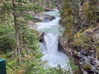
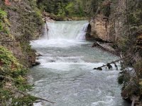
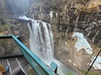
I imagine there was still significant snow melt as the river was raging. There were several picturesque waterfalls along the trail. The trail would be on the bank by the river but also the walkway would be anchored into the canyon wall and the visitors would be walking over the river. Really cool.

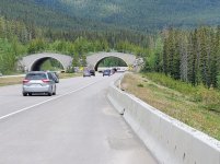
Wildlife crossing in Banff. There are several.

20220620_093042.jpg

20220620_104342.jpg 20220620_104652.jpg

20220620_105512.jpg 20220620_110527.jpg

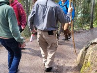
People watching is always an enjoyable experience. I had a chuckle seeing these two on the trail.

There were several hundred people along the trail, but this guy was not going to let a bear single him out. He was carrying his bear spray.

20220620_111256.jpg

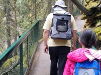
This guy and his wife ahead of him were carrying backpacks with their cats in them. Cats like walking tours, too I guess.

20220620_113251 (1).jpg

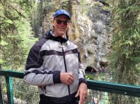
A guy from India asked me to take a picture of him and his wife. I obliged and asked him to take one of me with the waterfall. He must not have understood me, and he snapped me in front of the waterfall. Oh, well.

20220620_104050.jpg

I am writing this on the morning of June 21st. I have more to tell about this day but my time is running short and I need to ride to Dawson Creek. I don’t expect to experience much today so I will plan to finish my update this evening.
 
Last edited:
June 20th
Continued…

After I finished up at Johnston Canyon I rode up to Lake Louise. Lake Louise is a hugely popular area and being around noon the parking was full and people had to park and ride to get into the area. I just wanted gas, so I pulled on into the station and topped off my tank. I didn’t need much but I had read stories about how pricey gas would be at Saskatchewan Crossing, the mid-point of the north/south drive through Banff and to Jasper. There is nothing else between Lake Louise and Jasper. A full tank would get me to Jasper.

After topping off I saw the sign that said Alaska Highway/Jasper and headed out. Banff/Jasper reminds me of Yellowstone. Everything is spread out and significant driving is required to see most if not all of it. After a while I started wondering when I would see a sign that pointed out a location I wanted to see. I figured I would eventually see something. On I drove, through some mountain construction and into a decent sized town called Golden. This did not look right. I don’t remember a town of this size on the road to Jasper. I pulled up my GPS and it told me to turn around! I had missed my exit coming out of Lake Louise? I had driven over 60 miles out of the way! Yes, it takes me that long to figure out I made a mistake. Oh, Crap! With a capital C! I was disheartened with this blunder, and it didn’t help when premium gas was $10 CD a gallon. The exchange rate brought it down to $8 US. Hey, I’m needing silver linings at this point. I turned around and started back. It was over a 2 -hour mistake. Turns out the exit to Jasper and the Icefield Parkway was about a mile out from Lake Louise and I wasn’t paying attention that quickly. On the way back I did see a moose grazing at the side of the road. I’m assuming it was a female because I did not see antlers.

So, I was finally back at Lake Louise, filled my gas tanks, again, and headed for the Icefield Parkway. Seeing the amazing sights quickly changed my attitude back to one of wonderment.
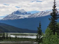
One of the things I enjoyed about the Icefield Parkway is the road is in a valley. You can look out to both sides and see towering, snow capped mountains. In Colorado, you drive IN the mountains and must look straight up to see anything. Since the Icefield Parkway is in a valley, it is relatively flat where in Colorado you must fight elevation and the corresponding de-elevation.

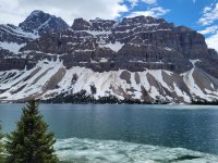
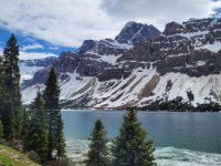
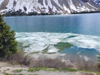
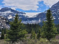
Bow Lake

20220620_155915.jpg 20220620_155933.jpg


Yes, that is ice in the foreground.

20220620_160024.jpg 20220620_161029.jpg


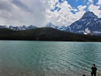
I didn't catch this lake's name

20220620_162905.jpg 20220620_170542.jpg


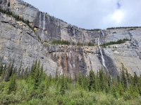
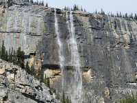
Weeping Wall
Several waterfalls

20220620_171912.jpg 20220620_171924.jpg


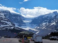
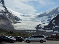
Columbia Icefield and glaciers

20220620_174412.jpg 20220620_174649.jpg


By the time I finished viewing the Athabasca Glacier I decided I needed to head on to my evening destination at Hinton, AB. It was still more than two hours away and it was already 6 pm. I left Calgary at 7:30 am and I arrived in Hinton at 8:30 pm. It was a long day with hours of unnecessary riding and I was ready to hit the bed early.
 
Last edited by a moderator:
June 21st

Hinton, AB to Dawson Creek, BC

Since I arrived at my motel so late the previous evening I decided to lounge around a bit in the morning and write the first part of the Banff day. I had a ride day of only 5 hours, so I had time to spare.

I had only traveled about 50 miles on my current tank of gas. I google mapped 146 kilometers to the next town, Grand Cache. That is roughly 91 miles. There is a sign at the start of the road I was taking that said there are no services for 146 kilometers. They mean nothing, no gas, no restaurant, nothing! I had enough gas to make it but why worry. I topped off and hit the road close to 10 am.

Alberta has a significant logging industry. I saw signs that stated what year a certain section of timber had been harvested, what year it was replanted and what year it would be harvested again. Usually, it was sixty years for the trees to reach mature growth.

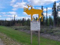
I came across some signs warning of moose activity and migration. Caution! Moose Crossing sign.
20220621_105248.jpg

I saw a couple signs that warned of moose migration areas and even a “hot spot” but I did not see any moose. It did help the time go by as I was diligently looking for moose.

I filled up in Grand Cache and began my trek towards Grand Prairie. It was 190 kilometers or almost 120 miles with no service. There was the cautionary sign about no services as well. Not a problem for a full tank but as the old saying goes “Don’t leave home without a full tank” or something close to that.

I didn’t look up the population of Grand Prairie, but it is big enough to have a Costco. I took a lunch break and readied myself for the final leg of the day. The road into Dawson Creek was not so isolated and passed through a couple small towns. One of them was Beaverlodge. Now I have a big beaver to go with my big moose!
20220621_151400.jpg

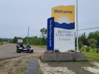
Also, another Canadian province is crossed.
20220621_154752.jpg

I would have driven up to the front of the sign but there was a car blocking the way. After taking the picture I noticed the license plate was from Nebraska. An elderly couple were sitting in the car and I walked to the driver window and waved. The older man just looked at me so I made the hand sign for roll down your window. He looked away and his wife opened her door and leaned her head out. I said "You're from Nebraska?" she said "Yes". I said "We're both far from home as I'm from Kansas." She is "Yes", pulled her head back in and closed the door. The first time in several days I had talked to a fellow American and they acted like I was going to rob them.

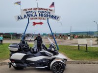
The main road into Dawson Creek leads right to the world famous Alaska Highway sign. There were a few people taking pictures at the Alaska Highway sign so I waited my turn. A big truck pulling a monster fifth wheel trailer moved out of the way and I positioned my bike in front of the sign. The couple got out of the truck to walk their dog so I asked them to take my picture. The wife said " Sure, where in Johnson County are you from?" Another small world moment. They had previously lived in Overland Park but had retired and moved to Prescott, AZ. They are traveling and pulling that monster RV with the end destination to see their son who is stationed at a base in Alaska. Yes, friendly Americans!

20220621_152538.jpg

I’ve been on the road for several days, yet the adventure is really just beginning. I am taking a day of rest tomorrow. I’m going to wash clothes, wash my bike, tour the city and mainly just rest as I prepare for the Alaska Highway.
 
Great pictures and narrative.

We also had a "garmin" moment on our trip from AK to AR three years ago. Missed a turn in IA and we went 40 miles out of the way before I figured something was wrong. Life happens. :bowdown: :roflblack:
 
Wow! Great write-up and great pictures. I feel like I'm "watching" a documentary, good job of taking us along for the ride!

Thanks for these posts!
:clap:
 
June 22nd
Dawson Creek Day of rest

Today was a scheduled day of rest. I have been on the road for seven straight days (counting the pre-trip to Nixa). The longest time I had previously spent on the Spyder was 5 days, so I planned to have an off day and having a day of rest before riding the Alaska Highway seemed like a good idea.

I did lots of housekeeping things today. My motel has a guest laundry, so I did a load of laundry. Even though I will be traveling a month, I only take a weeks’ worth of clothes and plan to wash them each week.

I made the next four nights of motel reservations. I usually like to make hotel reservations only one day ahead but with the limited rooms available in some locations I thought it prudent to book out ahead more than usual. Some motels were on the third-party websites, others I had to call directly.

I filled my gas tank and wiped down the windshield.

I went to a local grocer and replenished a few items. I am carrying a small cooler where I keep a few bottled waters, lunch meat, wraps and cheese to make a lunch time wrap while on the road. Since I have limited space in the cooler, I only keep about 3-4 days’ worth of lunch items, sometimes a dinner item. I also have a bag in my top case with a few other supplies, snacks and goods.

I visited the local visitors’ center. I picked up some literature about the destinations I would be passing through but the most important item I picked up was a brochure of the camping/hotel/GAS locations along the Alaska Highway and started making notes about when I would stop for gas. I had an old brochure I had downloaded a few years ago and I did notice a few changes.

I browsed TripAdvisor to see what sights I should see in Dawson Creek. Turns out there aren’t any. Take a picture of the Alaska Highway sign and the original starting point which is two blocks away from the big sign is about it. Some time ago the big sign was put up to minimize congestion in downtown.

Mile zero.jpg

My next planned day off will be in Fairbanks, AK. Only 1500+ miles based on the Mile Zero marker!
 
Thanks for the words of encouragement. While I am enjoying my trip, it is not an easy one. My 2020 RTL is purring along and as long as the bike is happy, I'm good.
 
Up until now it has been relatively cheap. I've been staying in motels that run about $90 to 100 a night. I stay away from the REALLY cheap. Dawson City on into Alaska I'm probably looking at $175 range with a single night or two in a room that might cost closer to $200. I'm planning on an average of $130 for the trip. Gas is crazy expensive. Premium is running $6.81 a gallon US. I'm biting the bullet because I've planned on doing this trip for four years and there is no guarantee in life that I can do it next year. Or even cheaper next year. Watson Lake was my biggest concern. The distance would be too great if I missed that stop. I thought I might have to cross off Dawson City but a room finally opened up. So, I've got those two taken care of. Tok, AK will be my next stop of concern but I can travel on from there if necessary.
 
June 23rd
Dawson Creek to Fort Nelson

I checked the morning weather report, and it did not look good. The weather radar had a rain cell moving to the south through Fort Nelson and on to Dawson Creek. I would be riding directly into it. No escaping scattered showers this time.

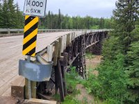
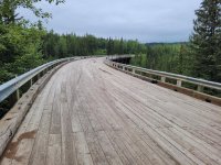
The rain didn’t hit right away. I had clear riding for about the first hour. I did a short detour to see the Kiskatinaw Bridge. This bridge is from the original Alaska Highway built in 1942-43. It is a wooden, curved bridge. As truck loads became heavier, a stronger bridge was needed and built in the 1970’s. This section of historic road leaves and then meets back up with the current highway. Alas, time takes its toll on everything, and the bridge had to be recently closed due to some boards rotting and breaking. Still a neat bridge to see.

20220623_083149.jpg 20220623_083205.jpg

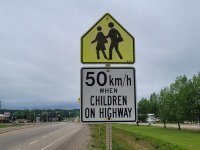
It was still a cool but pleasant morning for riding and as I drove through a small town, I couldn’t help but do a double take on this sign.

“Please, Mommy, can I play on the highway today?”
20220623_090229.jpg

My first gas stop was in Fort St. John, population 20,000. The last sizable town for a couple days. I only needed about a gallon and a half of gasoline, but it would take me to the next stop at Pink Mountain. Once I got north of the city, I saw grey skies ahead and pulled over to put on my rain gear. I don’t have rain boots as such but a pair of over-boots that go over my shoes. They look dorky but work. However, I had my riding boots on, and they don’t fit all that well inside the over-boots, so I decided to not use them. It was a decision I would regret making.

The rain hit and it was a steady rain. Visibility was limited. My boots are mesh boots, better suited for summer riding and they soon became waterlogged. It was 46 degrees, raining and my feet were freezing. I could feel the water slosh about every time I moved my feet. My body was holding up ok in the rain suit, but my feet were suffering from poor decision making.

The speed limit is normally 100 KM or 62 miles an hour. I was surprised how many semi-trucks were going above that limit in the rain. I was following an SUV pulling a U-Haul trailer. Again, visibility was limited in the grey haze of rain and clouds. A semi decided to pass both me and the SUV at the same time. A pick-up truck was coming the opposite direction but did not have its headlights on. The semi swerved back in the right lane, cutting off the SUV and forcing him onto the shoulder. Fortunately, no accident but the driver of the SUV had a major Pucker moment.

I rode in the rain for two hours until the gas station/convenience store at Pink Mountain appeared. The rain was starting to let up while I pumped gas. Afterward, I went into the bathroom and pulled off my soaked boots and socks and put on dry sneakers, socks and the over-boots I should have done 2 hours ago. As I was coming out of the bathroom I saw and smelled a fresh pot of coffee brewing, so I decided to stay warm and have a cup for the next fifteen minutes.

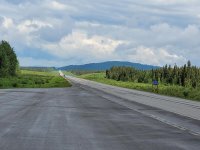
The rain had paused while I was gearing up and a gentleman from Ontario stopped me and talked to me about the Spyder for a few minutes. As I got on the road it was not raining but ominous, grey clouds threatened me for the next hour but did not let loose any rain. The sky started to break so I pulled over at a turnout and had lunch and a break. Here is what I saw for the rest of the afternoon.

20220623_131448.jpg

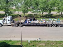
I pulled into Fort Nelson, my layover for the night. As I was unloading, I heard a police siren going off. It kept going off and then I saw it was leading 2 semi-truck pulling open trailers down the service roads with kids on them. Small towns are the same all over.
20220623_153344.jpg

At the hotel I met another couple from the same county I live in. Small world moment. Tomorrow I will have a longer riding day as I head to Watson Lake.
 
Last edited by a moderator:
Just started reading your ride report, great writeup.

When you mentioned going through Carrington SD and taking the picture of the Chieftain Motel I had a flash back. 2 years ago we did a big trip from Calgary to Newfoundland and we had an unexpected stay in Carrington and eating at the Chieftain Cafe. When we were traveling through the small town of Drake SD, NW of Carrington, a severe weather system suddenly came up. A lot more to the story but do not want to hijack your ride report, just to say we ended up riding next to a tornado, edge of the storm on highway #52/#200. My wife was so scared and both of us soaking wet even though we had waterproof everything on, we ended up calling it a day in Carrington, (oh ya I was having more then a pucker moment as well).

Take care.
 
Both cities are in North Dakota.. Common mistake

:hun: . Not a local or even living in the same country or on the same continent, so I'm really not sure what this ^^ applies to (along with at least a few others... :rolleyes: ) - any hints?? :dontknow:
 
Back
Top