I have a Garmin Zumo XT mounted on the handlebars of my Spyder.
One of my friends suggested a place for me to visit, along with a nice little cafe near the destination. I've never been to that area, so don't know anything about the roads to or from the area.
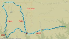
I do have Basecamp installed on my Mac computer, but when I asked it to create a route it went crazy. It should have been a fairly straight route, as there's a state highway that runs directly from the city where I live to the area where the cafe is.
Google maps says it's about 45 miles.
Basecamp suggested an alternate route, that included detours off the state highway, often looping back to rejoin the highway prior to the place the route left the highway.
After spending way too much time trying to manually "fix" the route, often causing Basecamp to add even more off route loops, I gave up.
What I ended up doing was plotting the route using Google Maps. I logged into Google Maps, created the route, then exported it to a GPX file.
Then I imported the Google GPX file into Basecamp, and then synced it to my Garmin Zumo XT.