View Poll Results: Favorite form of trip planning
- Voters
- 99. You may not vote on this poll
-
Maps
-
GPS
-
Phone Apps
-
All of the above
-
Active Member
 Poll on navigation preferences Poll on navigation preferences
Lets start a poll
1.I prefer Maps
2.I like GPS
3.I like phone apps
4.I use all of the above
Last edited by Peter Aawen; 11-05-2019 at 08:27 AM.
Reason: Title
   : 
: 2017 RTL ORBITAL BLUE
-
Very Active Member

I'm old school still using paper maps. I tried to use the Garmin GPS (pos) when we got our 2014 RT as it was part of the deal. I soon realized it really isn't much removed from texting and driving which is now the #1 cause of traffic accidents in the US. I don't want to be a part of that, so I'll do my best to memorize my routes and stop from time to time to get back on track because I know my memory will not be sufficient. We do keep the GPS handy in the event we are totally lost but that is a last ditch choice. I do my best to not be in a big hurry when on the Spyder or a bike, so being able to get instant location information is not so important that I cannot stop for a few minutes to consult a paper map.

Those who say " I can't" will always be right.
-
Very Active Member


Lately, Garmins in all the vehicles have decided upon routes that make no sense. Typically, in the car or truck, if it seems wrong, the Googlemaps in the phone overrides the Garmin.
I truly wish Garmin had their stuff more modernized regarding routes, ability to select routes on the unit and more.
All that said, The Garmin 660 still is used on the Spyder, regardless of how confused and lost the Garmin gets us...
-
Very Active Member

Paper maps, my memory (not reliable), Garmin, phone in that order. I do not really understand how to use the Garmin to plan a route, tho I can use it to find specific addresses or POI's.

Happy TRAils/NSD
Paul
2012 RT L
AMA 25 years Life Member
TRA
PGR
Rhino Riders Plate #83
Venturers #78
TOI

-
Very Active Member


 Originally Posted by pegasus1300

Paper maps, my memory (not reliable), Garmin, phone in that order. I do not really understand how to use the Garmin to plan a route, tho I can use it to find specific addresses or POI's.
You are not alone in the difficulty understanding how to plot routes in a Garmin. When we got ours with the Spyder, I also did the free download of their software called Base Camp. I spent at least twenty hours or more over the course of a few days trying to figure it out. I've decided my 10 year old MS Streets & Trips is a better program. I can plan a long route with as many turns as I want in less than 15 minutes. Unfortunately, I found out the Garmin cannot handle a complicated route like that so I quit trying to transfer them to it and just do multiple screen shots of my S&T route then load them into my phone as back-up in the event I need a quick reference before taking the time to pull out a paper map.

Those who say " I can't" will always be right.
-
Active Member


Phone with WAZE app, allows us to find the back road routes. Pretty good at rerouting if there is any traffic issues. Alerts if police are presents (user input). No need to look at it once I input route step by step instructions in my ear piece.
-
Very Active Member

None of the above. You can't get lost if you don't care where you are going. Eventually you will cross a major highway that you know where goes. I do have some of the old plastic maps.......... not paper, the plastic ones will stay together after they get wet. Hardly ever look at them. Most of the time I know just about where I am.
-
Very Active Member


I am also "old school." Part of the excitement of a new trip is bringing out the atlas and scouting the possibilities.
Years ago, our winters in MN were spent searching out "new" canoe routes and places to explore. We discovered some great stuff that way and over 20 years, we went to hundreds of lakes in the boundary waters area.
That has carried forward to our motorcycle tripping. For detail, on all the small roads here, I have added a Gazetteer book. It has more information that you could want. Our area is criss crossed by many, many interesting roads. It's amazing the rides I have discovered within a 100 mile radius of home base.
We purchased a Garmin for the car when we made our 4000 mile journey from AK to AR. I found it to be disappointing and a couple times, we got mislead in where we wanted to go.
I used it for the trip, but it sits on a shelf in my desk now.
  Currently Owned: 2019 F3 Limited, 2020 F3 Limited: SOLD BOTH LIMITEDS in October of 2023.
Previously : 2008 GS-SM5 (silver), 2009 RS-SE5 (red), 2010 RT-S Premier Editon #474 (black) 2011 RT A&C SE5 (magnesium) 2014 RTS-SE6 (yellow)
MY FINAL TALLY: 7 Spyders, 15 years, 205,500 miles
IT HAS BEEN A LONG, WONDERFUL, AND FUN RIDE.

-
Very Active Member


Combinations depending on interest, if I know an address Garmin can fig a route per the settings (might change setting at a stop if it finds a wonky gravel road<AR>) it does take time fooling with & learning but if on a poker run that provides multiple addresses the custom route planner can be handy in fastest or shorter options arranging what order to attempt (program be night before) & some places the address is right but gps is off (E TX)google maps offers alternative & satellite or street view. Can Bluetooth phone audio to headset & use Garmin as digital map just to see upcoming intersections. When hard spots are found save POI on both some best views don’t have address. forgot the Garmin also has a option fuel gauge setting & you input a mileage range set what buffer miles you want, in addition to a trip meter whenever you reach your buffer mileage a fuel icon is displayed & can provide you with list & reroute to station of your choice forgot the Garmin also has a option fuel gauge setting & you input a mileage range set what buffer miles you want, in addition to a trip meter whenever you reach your buffer mileage a fuel icon is displayed & can provide you with list & reroute to station of your choice could use some streamlining (not list stations in opposite direction) but handy all the same as long as you reset it with fill ups could use some streamlining (not list stations in opposite direction) but handy all the same as long as you reset it with fill ups also FYI have only used the Google maps app,Garmin,& a TOMTOM. Each have their quirks usually adjustable in settings, either way all take some getting familiar with to be proficient. also FYI have only used the Google maps app,Garmin,& a TOMTOM. Each have their quirks usually adjustable in settings, either way all take some getting familiar with to be proficient.
Last edited by Bfromla; 11-06-2019 at 01:34 AM.
Reason: 4got
 2013 STL SE5 BLACK
 CURRANT
SpyderPop's: LED bumpskid
SmoothSpyder: dualmode back rest
T r * * LED:foam grip covers, Tricrings, FenderZ,
brake light strips, wide vue mirrors
Rivico SOMA modulation brake leds
sawblade mowhalk fender accents
minispyder dash toy
Lid lox
KradelLock
Pakitrack
GENSSI ELITE LED H4 headlights
FLO (Frunk Lid Organizer)
BRP fog lights, trailer hitch
SENA 20S EVO
-
RT-S PE#0412

 My favorite form of trip planning. My favorite form of trip planning.
My favorite form of trip planning. Will use going to Cuba MO. for my first spyderfest.
1. Google maps Los Angeles to Cuba MO. with a stop in Austin TX to visit my brother.
2. How far on average do I want to ride each day 500-700 miles.
3. Average 115 miles or 5 fuel stops, check where gas stations are. Get address and put in my Garmin Zumo 660
4 Look on google maps for hotels ie:Comfort inn Best western, jot down # to call for reservation.
5 Check storm radar app on I phone to see if I need to make any detours.
-
formerly pman2011

Custom route using google maps or Garmin basecamp then export the gpx file to Garmin GPS.
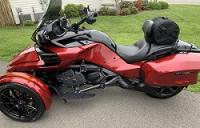
[B] 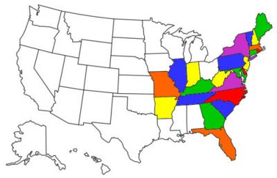 2018 Intense Red F3T
 (See About Me under My Profile for mods)
2010 Timeless Black RT-622 Trailer
2014 Timeless Black RTS-SE6, 34,300 Miles, traded May 2019
2011 Timeless Black RTS-SE5, 15,180 Miles, traded April 2014
-
Very Active Member
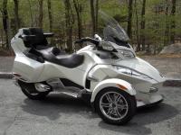

A good paper map is a good place to start because you can get a good feel of the lay of the land and take in some of the highlights!! The when your on your way then you can let your fingers do the walking and find all the gas stations, hotels ect!
-
Customer Support

I'll start with Google earth or Google maps to get a better idea of route availability.
I will try, with mixed success sometimes, to use Basecamp then transfer to the Zumo. Like to have waze as a backup but if there is no signal it's not a lot of help.
I'll usually have a paper backup.
2015 Pearl White RTL
Baja Ron Sway Bar
Russell Day Long Seat
Strobe Brake Light
Mirror Mount Turn Signal Indicator

-
Active Member


I like that idea of taking pics of map that I can just follow and change pic when I reach end of map section.
   : 
: 2017 RTL ORBITAL BLUE
-
Active Member


Love Waze for police info
   : 
: 2017 RTL ORBITAL BLUE
-
Active Member


 Originally Posted by Mikey

A good paper map is a good place to start because you can get a good feel of the lay of the land and take in some of the highlights!! The when your on your way then you can let your fingers do the walking and find all the gas stations, hotels ect!
This is my typical method
   : 
: 2017 RTL ORBITAL BLUE
-

I use Google Maps for planning purposes.
2014 RTL Platinum

-

Google to plan the route. Phone app (Sygic) for GPS. I create the route I want in the app and it's extremely easy and way more portable than carrying a laptop. Stopped using a laptop many years ago. I have paper maps as a backup. I also know the route as I check Google and zoom in to make sure of stops and hotels, so I know what I'm looking for and the GPS helps.
-
Very Active Member

 2013 STL SE5 BLACK
 CURRANT
SpyderPop's: LED bumpskid
SmoothSpyder: dualmode back rest
T r * * LED:foam grip covers, Tricrings, FenderZ,
brake light strips, wide vue mirrors
Rivico SOMA modulation brake leds
sawblade mowhalk fender accents
minispyder dash toy
Lid lox
KradelLock
Pakitrack
GENSSI ELITE LED H4 headlights
FLO (Frunk Lid Organizer)
BRP fog lights, trailer hitch
SENA 20S EVO
-
Active Member


I use my GPS as much to glance at to see what is ahead as for routing, but major trips we usually have about 8-10 guys, all with GPS's... somebody always feels ambitious enough to plan the route for the day!
 
You can't get there from here....
Mods and Tweaks:
Showcrome Trunk Rack
Showcrome LED Trunk Light
Garmin 390LM
Spyderzone Floating Hiway Boards
Spyderzone Mount Dash Bracket
BajaRon Antisway Bar
Showcrome full-size brake pedal
Spyder-2-Go Driver Cup holder
Ram X phone mount
SpyderExtras 12 volt Docking Station
BRP Driver Backrest
Monster 4K Action Camera
Spyderzone LED Fender Mount Spotlights
CASA LED Headlights and Foglights
-
Active Member

 Originally Posted by YIRYDE

Custom route using google maps or Garmin basecamp then export the gpx file to Garmin GPS.
Silly question but can't seem to find the answer here in OZ, is google maps able to be used outside a mobile ph [cell] area, similar to Genius and other offline apps.
-
Active Member


 Originally Posted by Airborne

Silly question but can't seem to find the answer here in OZ, is google maps able to be used outside a mobile ph [cell] area, similar to Genius and other offline apps.
Google maps allows you to download the route (offline map). Basically you have to plan your route and download it while you have service. If you end up in a dead zone you can still use the step by step guidance
Check out this information: https://support.google.com/maps/answ...rm%3DiOS&hl=en
-
SpyderLovers Ambassador
 Navigation Navigation
 Well, that's a good question. Well, that's a good question.
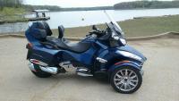
I usually get out the USA paper map book. I love to look and plan my next road trip.
I also have GPS and state maps for Tips. .......
ENJOY YOUR LIFE WITH A SPYDER
Ryde with a Friend and be Safe
My Spyder ..... 'Little Blue-Boy'
-

Google Maps for me. I don't have any paper maps, I use the internet to search out locations and stuff to do on the way to where I'm going, I plug in where I want to go, turn on my SMH-10R, and go.

2017 Can-Am Spyder RT
-
Active Member


Sygic maps on phone through BRP Connect. Better than my Garmin.
 Posting Permissions
- You may not post new threads
- You may not post replies
- You may not post attachments
- You may not edit your posts
-
Forum Rules
|

